- Contact Us
- +91-98111-55335
- [email protected]

A Travel Tool That Solves Luggage Woes
November 29, 2019
Augmented Reality Revolutionising Sports
November 29, 2019Satellite Data Enabling Better Decision Making
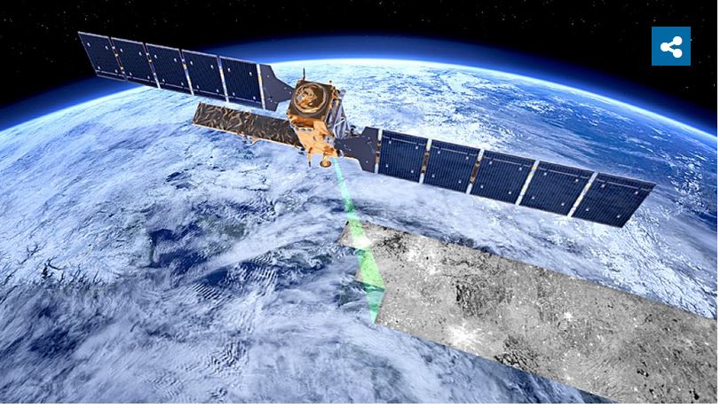
Use of satellite data helps gov-ernments and industries make better decisions at the right time and provide new services. ICEYE has developed its synthetic-aperture radar (SAR) sensor technologies suitable for satellites weighing under hundred kilograms. It has launched a small satellite SAR imaging constellation, which is customised for high revisit rate and frequent delivery of high resolution imagery.
The satellite can provide accurate data of any location on Earth, regard-less of weather conditions, through cloud cover and darkness. This enables regular monitoring of vast sea, large land areas and atmosphere, and frequent imaging of hard-to-reach regions. ICEYE satellite constellation provides new images of the same location every hour, tracking all changes that happen.
X-band radar imaging is available at 1×1-metre resolution as Spotlight, at 1.5×1.5-metre and 3×3-metre resolutions as Stripmap, and 20×20-metre resolution as ScanSAR. The initial six-satellite constellations for 2019 were launched in orbit in three different inclinations, with two satellites in each inclination. This provides different angle imaging multiple times a day for specified areas of interest.
ICEYE SAR processor compensates the following effects: range spread loss, elevation antenna pattern, sensor settings variation (receiver gain, transmit power, duty cycle), effects of different azimuth and range bandwidths. Remote sensing devices with electrooptical (EO) sensors can be carried with various platform groups: space-borne includes satellites, shuttles or space stations; airborne includes manned or unmanned aircraft, aerial vehicles, etc; and ground-based includes installed sensors, mobile devices, animals or humans.
Fundamental differences between EO technologies depend on whether data is collected through a passive or an active remote sensing system. Passive remote sensing monitors solar energy, which Earth’s surface or atmosphere reflects and reemits into space. This technology delivers data only in sunlight and cloudless circumstances. Commonly used passive sensors include optical and thermal sensors, while active sensors include radar and laser technologies. Active remote sensing measures the energy received back from the Earth’s surface or atmosphere.
There are two types of radar based systems that are used for satellite-based microwave imaging: real aperture radar (RAR) and SAR. SAR can penetrate clouds and does not require sunlight to provide reli-able remote sensing data. Machine learning algorithms are used to scan huge data masses of satellite imagery and to develop models to extract features, detect changes and predict upcoming situations with the help of artificial intelligence (AI).
Volume of applications is huge, and it is rapidly increasing. Given below are some examples of satellite data uses:
• Forestry planning and prevention of illegal logging
• Prevention of illegal fishing
• Solar plant and oil pipeline monitoring
• Mapping of floods, fires and effects of other natural disasters for insurance purposes
• Infrastructure planning and construction
• Iceberg tracking and monitoring, oil spill detection, port monitor-ing, foreign vessel detection
• Fast response to natural catastrophes like hurricanes
• Security surveillance
• Harvest monitoring and field segmentation
When activities, issues, changes and trends can be detected, monitored and analysed more efficiently with satellite data, benefits for people and the environment can be tremendous.